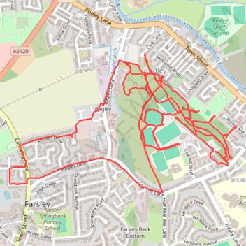
Trace of trails for Coal Hill, Rodley
- Distance: 6.2 mi
- Elevation gain: 696 ft
- Maximum elevation: 361 ft
- Elevation loss: 696 ft
- Minimum elevation: 210 ft
- Moving time: 1 h 31 m
- Moving speed: 4.0 mph
- Maximum speed: 8.6 mph
- Total time: 1 h 37 m
- Global speed: 3.8 mph
Interactive trail map
Trail profile
- Distance: 6.2 mi
- Elevation gain: 696 ft
- Maximum elevation: 361 ft
- Elevation loss: 696 ft
- Minimum elevation: 210 ft
- Moving time: 1 h 31 m
- Moving speed: 4.0 mph
- Maximum speed: 8.6 mph
- Total time: 1 h 37 m
- Global speed: 3.8 mph
About this trail
Name: Trace of trails for Coal Hill, Rodley trail, distance, elevation, map, profile, GPS track
Coordinates: 53.81490 -1.67205 53.82171 -1.65330