Lunch Walk
- Distance: 0.4 mi
- Elevation gain: 0 ft
- Maximum elevation: 2,290 ft
- Elevation loss: 157 ft
- Minimum elevation: 2,129 ft
- Moving time: 7 m 15 s
- Moving speed: 3.3 mph
- Maximum speed: 4.2 mph
- Total time: 7 m 15 s
- Global speed: 3.3 mph
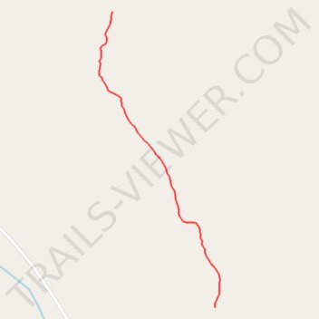
Interactive trail map
Trail profile
- Distance: 0.4 mi
- Elevation gain: 0 ft
- Maximum elevation: 2,290 ft
- Elevation loss: 157 ft
- Minimum elevation: 2,129 ft
- Moving time: 7 m 15 s
- Moving speed: 3.3 mph
- Maximum speed: 4.2 mph
- Total time: 7 m 15 s
- Global speed: 3.3 mph
About this trail
Name: Lunch Walk trail, distance, elevation, map, profile, GPS track
Start: Deep Creek Road, Yukon, Canada (61.08057 -135.21818)
End: Deep Creek Road, Yukon, Canada (61.07567 -135.21467)
Coordinates: 61.07567 -135.21863 61.08057 -135.21449
Other hiking, mountain biking, running and outdoor activity trails
Click on a trail to view its statistics, map and profile.
South Trails near Fossil Pt Road
Distance: 2.9 mi • Elevation gain: 367 ft • Maximum elevation: 2,251 ft
Laberge Mt Bike Ride
Distance: 11.6 mi • Elevation gain: 1,027 ft • Maximum elevation: 2,415 ft