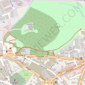
Warwick Woods
- Distance: 0.6 mi
- Elevation gain: 82 ft
- Maximum elevation: 253 ft
- Elevation loss: 16 ft
- Minimum elevation: 174 ft
- Moving time: 11 m 38 s
- Moving speed: 3.0 mph
- Maximum speed: 3.8 mph
- Total time: 11 m 38 s
- Global speed: 3.0 mph
Interactive trail map
Trail profile
- Distance: 0.6 mi
- Elevation gain: 82 ft
- Maximum elevation: 253 ft
- Elevation loss: 16 ft
- Minimum elevation: 174 ft
- Moving time: 11 m 38 s
- Moving speed: 3.0 mph
- Maximum speed: 3.8 mph
- Total time: 11 m 38 s
- Global speed: 3.0 mph
About this trail
Name: Warwick Woods trail, distance, elevation, map, profile, GPS track
Coordinates: 52.28357 -1.58903 52.28502 -1.58217