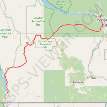
Christina Lake - Castlegar
Interactive trail map
Trail profile
- Distance: 49.4 mi
- Elevation gain: 4,744 ft
- Maximum elevation: 5,075 ft
- Elevation loss: 4,875 ft
- Minimum elevation: 1,381 ft
About this trail
Name: Christina Lake - Castlegar trail, distance, elevation, map, profile, GPS track
Coordinates: 49.03747 -118.23003 49.33807 -117.65364
Other hiking, mountain biking, running and outdoor activity trails
Click on a trail to view its statistics, map and profile.
Mount Gladstone hiking trail
Canada > British Columbia > Regional District of Kootenay Boundary > Area C (Christina Lake)
Distance: 8.8 mi • Elevation gain: 3,648 ft • Maximum elevation: 7,362 ft
Castlegar - Crawford Bay
Canada > British Columbia > Regional District of Central Kootenay > Area J (Lower Arrow/Columbia) > Raspberry
Kootenay River. #Bike
Distance: 56.6 mi • Elevation gain: 3,917 ft • Maximum elevation: 2,277 ft