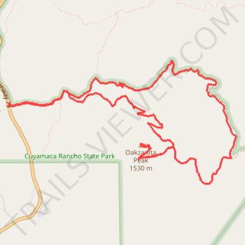
Oakzanita Peak loop trail
- Distance: 7.0 mi
- Elevation gain: 1,178 ft
- Maximum elevation: 5,013 ft
- Elevation loss: 1,178 ft
- Minimum elevation: 4,022 ft
- Moving time: 3 h 24 m
- Moving speed: 2.0 mph
- Maximum speed: 3.5 mph
- Total time: 4 h 7 m
- Global speed: 1.7 mph
Interactive trail map
Trail profile
- Distance: 7.0 mi
- Elevation gain: 1,178 ft
- Maximum elevation: 5,013 ft
- Elevation loss: 1,178 ft
- Minimum elevation: 4,022 ft
- Moving time: 3 h 24 m
- Moving speed: 2.0 mph
- Maximum speed: 3.5 mph
- Total time: 4 h 7 m
- Global speed: 1.7 mph
About this trail
Name: Oakzanita Peak loop trail trail, distance, elevation, map, profile, GPS track
Start: 11001, Highway 79, San Diego County, California, 91916, United States (32.89536 -116.57884)
End: East Side Trail, San Diego County, California, United States (32.89541 -116.57882)
Coordinates: 32.88663 -116.57884 32.90003 -116.54944
Topography: San Diego County topographic map, elevation, terrain