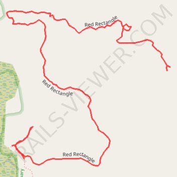
Meetinghouse Pond Red Rectangle Trail in Kensan-Devan Wildlife Sanctuary
- Distance: 0.8 mi
- Elevation gain: 171 ft
- Maximum elevation: 1,220 ft
- Elevation loss: 85 ft
- Minimum elevation: 1,106 ft
- Moving time: 32 m 20 s
- Moving speed: 1.5 mph
- Maximum speed: 5.2 mph
- Total time: 47 m 41 s
- Global speed: 1.0 mph
Interactive trail map
Trail profile
- Distance: 0.8 mi
- Elevation gain: 171 ft
- Maximum elevation: 1,220 ft
- Elevation loss: 85 ft
- Minimum elevation: 1,106 ft
- Moving time: 32 m 20 s
- Moving speed: 1.5 mph
- Maximum speed: 5.2 mph
- Total time: 47 m 41 s
- Global speed: 1.0 mph
About this trail
Name: Meetinghouse Pond Red Rectangle Trail in Kensan-Devan Wildlife Sanctuary trail, distance, elevation, map, profile, GPS track
Coordinates: 42.88549 -72.17920 42.88811 -72.17542
Topography: Cheshire County topographic map, elevation, terrain
Other hiking, mountain biking, running and outdoor activity trails
Click on a trail to view its statistics, map and profile.
Meetinghouse Pond Yellow Rectangle Trail in Kensan-Devan Wildlife Sanctuary
United States > New Hampshire > Cheshire County > Marlborough
Distance: 0.4 mi • Elevation gain: 59 ft • Maximum elevation: 1,152 ft