Import a GPX file

Alboletta trails

Click on a trail to view its statistics, map and profile.
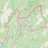
Riva del Garda - Pergine Valsugana

Italy > Trentino – Alto Adige/Südtirol > Provincia di Trento > Riva del Garda > Sant'Alessandro > Alboletta

One-way between Riva del Garda and Pergine Valsugana.

Distance: 120.1 mi • Elevation gain: 18,081 ft • Maximum elevation: 6,686 ft

Gear up for your next adventure:

🧭Pro Hiking Compasses - High-accuracy liquid-filled compasses for topographic orientation
📶Vehicle Signal Boosters - Improve reception in rural areas while driving to trailheads
🦟Ultrasonic Repellers - Create a bug-free zone at your camp or rest stop
🚪Portable Camp Chair - Foldable chair for comfort at camp
🦺Reflective Outdoor Gear - Safety gear for low‑light conditions

As an Amazon Associate, this site earns from qualifying purchases at no extra cost to you.