Import a GPX file

Great Witcombe trails

Click on a trail to view its statistics, map and profile.
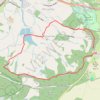
Birdlip Loop via Witcombe Reservoirs

United Kingdom > England > Gloucestershire > Tewkesbury > Great Witcombe

Distance: 4.9 mi • Elevation gain: 837 ft • Maximum elevation: 958 ft

Gear up for your next adventure:

🎁Geography Themed Gifts - Unique gift ideas for map lovers and geography enthusiasts
🎒Waterproof Dry Bags - Keep your electronics and maps dry inside your pack
🔭Stargazing Telescopes - Perfect for camping in low-light pollution areas shown on maps
🔭Compact Binoculars - HD vision for scouting terrain and identifying distant landmarks
🧺Microfiber Travel Towels - Compact and fast-drying towels for trail use

As an Amazon Associate, this site earns from qualifying purchases at no extra cost to you.