Import a GPX file

Montreal trails

Click on a trail to view its statistics, map and profile.
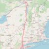
Montréal - New York

Canada > Quebec > Urban agglomeration of Montreal > Montreal

#Bike #Montréal #NewYork

Distance: 396.2 mi • Elevation gain: 15,945 ft • Maximum elevation: 988 ft

Pierreville - Leclercville

Canada > Quebec > Urban agglomeration of Montreal > Montreal

#Bike #Pierreville #Leclercville #Atlantic

Distance: 75.1 mi • Elevation gain: 1,063 ft • Maximum elevation: 118 ft

Montréal - Lanoraie

Canada > Quebec > Urban agglomeration of Montreal > Montreal

Saint Lawrence River. #Bike #Montréal #Lanoraie #SaintLawrence

Distance: 43.6 mi • Elevation gain: 594 ft • Maximum elevation: 171 ft

Montréal - Berthierville

Canada > Quebec > Urban agglomeration of Montreal > Montreal

#Bike

Distance: 44.2 mi • Elevation gain: 436 ft • Maximum elevation: 135 ft

Montréal - Westmount

Canada > Quebec > Urban agglomeration of Montreal > Montreal

#Bike #Montréal

Distance: 8.5 mi • Elevation gain: 108 ft • Maximum elevation: 197 ft

Gear up for your next adventure:

🥾Women's Hiking Boots - Top-rated trail boots with ankle support and superior grip
🧤Tactile Hiking Gloves - Keep hands warm while operating GPS and smartphone screens
🔋Solar Power Banks - Keep your GPS and phone charged in remote wilderness areas
🪶Wildlife Field Guides - Learn animal tracking and species ID
🗺️Topographic Maps - Detailed topo maps for hiking, exploring and outdoor navigation

As an Amazon Associate, this site earns from qualifying purchases at no extra cost to you.