Import a GPX file

Campbell County trails

Click on a trail to view its statistics, map and profile.
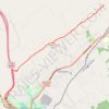
Cumberland Trail (CT) - Bruce Gap to Cumberland Mountain - Eagle Bluff

United States > Tennessee > Campbell County > Caryville

Distance: 8.9 mi • Elevation gain: 1,919 ft • Maximum elevation: 2,116 ft

Other places

Gear up for your next adventure:

🖼️Topo Map Wall Art - Decorative topographic prints of famous peaks and regions
🎒Outdoor Daypacks - Lightweight backpacks designed for carrying maps and essential gear
👓Polarized Sunglasses - Outdoor sunglasses for glare reduction
🌡️Portable Weather Meter - Track weather conditions on the trail
⛑️Personal Locator Beacon - Safety beacon for emergencies

As an Amazon Associate, this site earns from qualifying purchases at no extra cost to you.