Import a GPX file

Caryville trails

Click on a trail to view its statistics, map and profile.
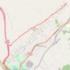
Cumberland Trail (CT) - Bruce Gap to Cumberland Mountain - Eagle Bluff

United States > Tennessee > Campbell County > Caryville

Distance: 8.9 mi • Elevation gain: 1,919 ft • Maximum elevation: 2,116 ft

Gear up for your next adventure:

🔋Solar Power Banks - Keep your GPS and phone charged in remote wilderness areas
🌧️Backpack Rain Cover - Keep gear dry in wet weather
🛠️Outdoor Gear Repair Kit - Essential tools to fix gear on the trail
🎒Hydration Pack - Hands‑free water reservoir for long hikes
🦟Ultrasonic Repellers - Create a bug-free zone at your camp or rest stop

As an Amazon Associate, this site earns from qualifying purchases at no extra cost to you.