
Mineral County trails
Click on a trail to view its statistics, map and profile.
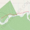
Mineral Creek Falls via Hoh River Trail in Olympic National Park
United States > Washington > Jefferson County
The Hoh River Trail to Mineral Creek Falls offers hikers a serene journey through the lush, moss-draped rainforest of Olympic National Park. Along the way, the trail meanders beside the glacial blue Hoh River, providing tranquil views of its clear waters. Upon reaching Mineral Creek Falls, hikers are treated…
Distance: 5.5 mi • Elevation gain: 804 ft • Maximum elevation: 797 ft

Tom LaBonge Panorama via Bill Eckert Trail and North Trail in Griffith Park
United States > California > Los Angeles County > Los Angeles
This trail to Tom LaBonge Panorama offers a moderately challenging hike in Griffith Park, winding through scenic vistas with views of Mount Hollywood, Taco Peak, and the iconic Hollywood Sign. The trail provides a rewarding panoramic perspective of Los Angeles, including landmarks like the Griffith Park Old…
Distance: 6.2 mi • Elevation gain: 1,512 ft • Maximum elevation: 1,568 ft
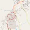
Mammoth Hot Springs Loop
United States > Wyoming > Park County > Mammoth
Starting near the Albright Visitor Center in Yellowstone National Park, this loop follows Grand Loop Road toward Palette Spring, where steaming runoff, warm mineral colors and open views introduce the Mammoth Hot Springs landscape. The route then crosses the Mammoth Terraces through Jupiter Terrace, Mound…
Distance: 2.8 mi • Elevation gain: 430 ft • Maximum elevation: 6,591 ft

Mineral Ridge Loop Trail in Idaho
United States > Idaho > Kootenai County
The Mineral Ridge Loop Trail offers a peaceful and scenic hike through a classic forest of the Inland Northwest. As you climb, you’re rewarded with panoramic views of Lake Coeur d'Alene, particularly over Beauty and Wolf Lodge Bays. The trail is well-maintained, with interpretive signs along the way, making…
Distance: 3.3 mi • Elevation gain: 1,010 ft • Maximum elevation: 2,946 ft


Cowles Bog Trail and Greenbelt Trail Loop around Little Lake in Indiana Dunes National Park
United States > Indiana > Porter County > Dune Acres
The Cowles Bog Trail and Greenbelt Trail Loopoffers a serene escape into a rich tapestry of diverse ecosystems, including black oak savannas, marshes, and ponds. Hikers can appreciate unique plant species, such as the carnivorous pitcher plants and striking wildflowers, while keeping an eye out for various…
Distance: 4.5 mi • Elevation gain: 207 ft • Maximum elevation: 682 ft
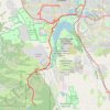
Waterton Canyon
United States > Colorado > Arapahoe County > Littleton
Distance: 35.7 mi • Elevation gain: 2,454 ft • Maximum elevation: 6,017 ft

Lake Mineral Wells State Park Hike
United States > Texas > Parker County
Distance: 7.5 mi • Elevation gain: 374 ft • Maximum elevation: 1,014 ft

Anderson Trail, Fourmile Falls area
United States > Colorado > Mineral County
Distance: 8.9 mi • Elevation gain: 3,005 ft • Maximum elevation: 11,575 ft