Import a GPX file

Greene County trails

Click on a trail to view its statistics, map and profile.
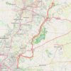
Little Miami Scenic Trail: Yellow Springs to Loveland

United States > Ohio > Greene County > Yellow Springs

Distance: 56.6 mi • Elevation gain: 1,785 ft • Maximum elevation: 1,030 ft

Other places

Gear up for your next adventure:

🥾Women's Hiking Boots - Top-rated trail boots with ankle support and superior grip
🧺Microfiber Travel Towels - Compact and fast-drying towels for trail use
🕶️Glacier Sunglasses - Side shields to protect eyes from high-altitude snow glare
🛰️Handheld GPS Units - Professional satellite navigators for precise backcountry mapping
🛌Ultralight Sleeping Bags - Compact down bags for cold nights in the wilderness

As an Amazon Associate, this site earns from qualifying purchases at no extra cost to you.