Import a GPX file

Yellow Springs trails

Click on a trail to view its statistics, map and profile.
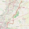
Little Miami Scenic Trail: Yellow Springs to Loveland

United States > Ohio > Greene County > Yellow Springs

Distance: 56.6 mi • Elevation gain: 1,785 ft • Maximum elevation: 1,030 ft

Gear up for your next adventure:

📡GPS Antenna Upgrade - Enhance GPS reception in remote terrain
📖Nature Tracking Books - Learn to track wildlife and terrain
🔦Powerful Headlamps - Ultra-bright hands-free lighting for night navigation
🧤Hiking Gloves - Protective gloves for rugged trails
🎒Waterproof Dry Bags - Keep your electronics and maps dry inside your pack

As an Amazon Associate, this site earns from qualifying purchases at no extra cost to you.