Import a GPX file

Maring trails

Click on a trail to view its statistics, map and profile.
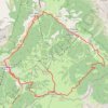
Badia Gravel/Offroad-Radfahren

Italy > Trentino – Alto Adige/Südtirol > South Tyrol > La Ila - Stern - La Villa > Maring

Distance: 18.0 mi • Elevation gain: 3,356 ft • Maximum elevation: 7,090 ft

Gear up for your next adventure:

📡GPS Antenna Upgrade - Enhance GPS reception in remote terrain
📶Satellite Messenger - Communication device off‑grid
🧥Waterproof Jacket for Hiking - Breathable and rugged rain jacket for outdoor excursions
🌡️Portable Weather Meter - Track weather conditions on the trail
📱Solar Portable Charger - Solar power bank for charging devices off‑grid

As an Amazon Associate, this site earns from qualifying purchases at no extra cost to you.