Import a GPX file

Landkreis Main-Spessart trails

Click on a trail to view its statistics, map and profile.

Uni

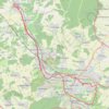
Germany > Bavaria > Landkreis Main-Spessart > Zellingen > Zellingen

Distance: 32.9 mi • Elevation gain: 1,191 ft • Maximum elevation: 886 ft

Other places

Gear up for your next adventure:

🚑Emergency Bivvies - Heat-reflective sleeping bags for survival situations
🎒Outdoor Daypacks - Lightweight backpacks designed for carrying maps and essential gear
🕶️GPS Smartphone Mount - Secure mount for phone navigation
🔌Solar Panel Charger - Charge gear sustainably outdoors
📚USA Hiking Guide Books - Top trail guides and map books

As an Amazon Associate, this site earns from qualifying purchases at no extra cost to you.