Import a GPX file

Zellingen trails

Click on a trail to view its statistics, map and profile.

Uni

Germany > Bavaria > Landkreis Main-Spessart > Zellingen > Zellingen

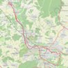
Distance: 32.9 mi • Elevation gain: 1,191 ft • Maximum elevation: 886 ft

Gear up for your next adventure:

📶Satellite Messenger - Communication device off‑grid
🪑Portable Camp Table - Compact table for campsite meals
🧺Microfiber Travel Towels - Compact and fast-drying towels for trail use
🏕️Tent Footprint - Protect your tent base from wear
🥘Titanium Cookware - Durable, featherlight pots and pans for backpacking

As an Amazon Associate, this site earns from qualifying purchases at no extra cost to you.