Import a GPX file

Gat Rimmon trails

Click on a trail to view its statistics, map and profile.
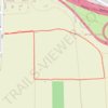
מסלול לסיור עששיות בין שדות כפר מע"ש

Israel > Center District > Drom HaSharon Regional Council > Gat Rimmon

Distance: 1.1 mi • Elevation gain: 49 ft • Maximum elevation: 174 ft

Gear up for your next adventure:

📱Heavy-Duty Phone Cases - Drop-proof and waterproof protection for outdoor navigation
🌡️Handheld Weather Meters - Measure wind, temp, and pressure for safe mountain travel
😴Insulated Sleeping Pads - Compact and warm pads for high-elevation camping
🚗GPS Dash Cams - Record your scenic drives through mountain passes and canyons
🔌Solar Panel Charger - Charge gear sustainably outdoors

As an Amazon Associate, this site earns from qualifying purchases at no extra cost to you.