Import a GPX file

Longfaye trails

Click on a trail to view its statistics, map and profile.
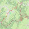
Naar de Neus van Napoleon

Belgium > Liège > Verviers > Malmedy > Longfaye

<p>Deze avontuurlijke wandeling langs de Warche brengt je naar het beroemde uitzichtspunt, de Neus van Napoleon. Hoe dat uitzichtspunt aan de naam kwam ontdek je op deze route.</p>

Distance: 8.3 mi • Elevation gain: 1,506 ft • Maximum elevation: 1,716 ft

Gear up for your next adventure:

🚗GPS Dash Cams - Record your scenic drives through mountain passes and canyons
🌧️Backpack Rain Cover - Keep gear dry in wet weather
☀️Outdoor Sunscreen - High protection sunscreen for outdoor activities
🔭Telescopic Hiking Pole - Adjustable pole for hiking stability
📌Outdoor GPS Map App - Apps and devices for digital topographic navigation

As an Amazon Associate, this site earns from qualifying purchases at no extra cost to you.