Import a GPX file

Sleepy Hollow Manor trails

Click on a trail to view its statistics, map and profile.
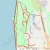
Rockwood Hall Loop

United States > New York > Westchester County > Town of Mount Pleasant > Sleepy Hollow Manor

Distance: 3.3 mi • Elevation gain: 331 ft • Maximum elevation: 184 ft

Gear up for your next adventure:

🎒Gear Packing Cubes - Organize your backpack efficiently
🔭Stargazing Telescopes - Perfect for camping in low-light pollution areas shown on maps
🧯Emergency Survival Kit - All‑in‑one survival essentials for the backcountry
🔋Solar Power Banks - Keep your GPS and phone charged in remote wilderness areas
📌Outdoor GPS Map App - Apps and devices for digital topographic navigation

As an Amazon Associate, this site earns from qualifying purchases at no extra cost to you.