Import a GPX file

North Grapetree Bay trails

Click on a trail to view its statistics, map and profile.
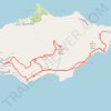
Trail near Point Udal connecting to GrapeTree

United States > United States Virgin Islands > Saint Croix District > North Grapetree Bay

Distance: 6.4 mi • Elevation gain: 1,263 ft • Maximum elevation: 607 ft

Gear up for your next adventure:

🪶Wildlife Field Guides - Learn animal tracking and species ID
🚗GPS Dash Cams - Record your scenic drives through mountain passes and canyons
🎒Outdoor Daypacks - Lightweight backpacks designed for carrying maps and essential gear
📷Action Camera - Capture your outdoor adventures in HD
📡GPS Antenna Upgrade - Enhance GPS reception in remote terrain

As an Amazon Associate, this site earns from qualifying purchases at no extra cost to you.