Import a GPX file

Dent trails

Click on a trail to view its statistics, map and profile.
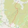
Hike from Dent to Masongill via Crag Hill, Great Coum, Green Hill and Gragareth

United Kingdom > England > Westmorland and Furness > Dent

Distance: 10.8 mi • Elevation gain: 1,975 ft • Maximum elevation: 2,254 ft

Gear up for your next adventure:

🔊Portable Camp Speaker - Music and alerts at camp
📷Action Camera - Capture your outdoor adventures in HD
⛑️Personal Locator Beacon - Safety beacon for emergencies
🪶Trail Camera - Capture wildlife on your hikes
🧭Hiking Compass - Precision compass for reliable navigation in the wilderness

As an Amazon Associate, this site earns from qualifying purchases at no extra cost to you.