
Hike from Dent to Masongill via Crag Hill, Great Coum, Green Hill and Gragareth
- Distance: 10.8 mi
- Elevation gain: 1,975 ft
- Maximum elevation: 2,254 ft
- Elevation loss: 1,978 ft
- Minimum elevation: 469 ft
- Moving time: 4 h 13 m
- Moving speed: 2.6 mph
- Maximum speed: 7.4 mph
- Total time: 5 h 45 m
- Global speed: 1.9 mph
Interactive trail map
Trail profile
- Distance: 10.8 mi
- Elevation gain: 1,975 ft
- Maximum elevation: 2,254 ft
- Elevation loss: 1,978 ft
- Minimum elevation: 469 ft
- Moving time: 4 h 13 m
- Moving speed: 2.6 mph
- Maximum speed: 7.4 mph
- Total time: 5 h 45 m
- Global speed: 1.9 mph
About this trail
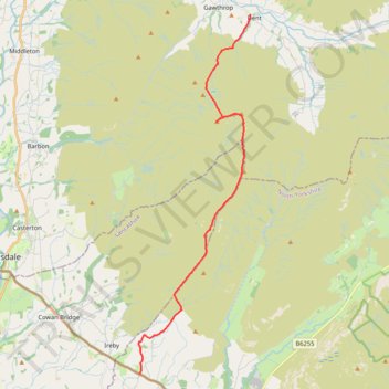
Name: Hike from Dent to Masongill via Crag Hill, Great Coum, Green Hill and Gragareth trail, distance, elevation, map, profile, GPS track
Start: Laning, Dent, Westmorland and Furness, England, LA10 5QJ, United Kingdom (54.27838 -2.45551)
Coordinates: 54.16437 -2.51603 54.27838 -2.45551