
Eatonville trails
Click on a trail to view its statistics, map and profile.
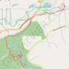
Little Mashel Falls Trail via Bud Blancher Trail
United States > Washington > Pierce County > Eatonville
The Bud Blancher Trail to Little Mashel Falls offers hikers a journey through serene forested areas, leading to the impressive Upper, Middle, and Lower Falls. The trail is well-maintained, though it can become muddy and slippery near the waterfalls, so appropriate footwear is recommended. #Hiking #Waterfall…
Distance: 4.2 mi • Elevation gain: 659 ft • Maximum elevation: 1,129 ft