
O’Fallon trails
Click on a trail to view its statistics, map and profile.
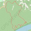
Lewis & Clark Loop Trail via Clark Trail in Weldon Spring Conservation Area
United States > Missouri > Saint Charles County > O’Fallon
The Lewis & Clark Loop Trail via the Clark Trail offers a scenic hike with a variety of natural landscapes. As you traverse the loop, you'll encounter beautiful bluff views of the Missouri River, particularly as you reach the higher elevations along the trail. The route also passes through diverse…
Distance: 5.3 mi • Elevation gain: 531 ft • Maximum elevation: 663 ft