Lewis & Clark Loop Trail via Clark Trail in Weldon Spring Conservation Area
The Lewis & Clark Loop Trail via the Clark Trail offers a scenic hike with a variety of natural landscapes. As you traverse the loop, you'll encounter beautiful bluff views of the Missouri River, particularly as you reach the higher elevations along the trail. The route also passes through diverse environments, including ridges, valleys, and occasional creek beds, enhancing the hiking experience with changing perspectives and opportunities for wildlife viewing, such as deer and birds. This trail provides a rewarding outdoor adventure with accessible terrain and striking river vistas. #Hiking #Loop #River #Forest #Nature
- Distance: 5.3 mi
- Elevation gain: 531 ft
- Maximum elevation: 663 ft
- Elevation loss: 531 ft
- Minimum elevation: 509 ft
- Moving time: 1 h 57 m
- Moving speed: 2.7 mph
- Maximum speed: 4.0 mph
- Total time: 2 h 4 m
- Global speed: 2.5 mph
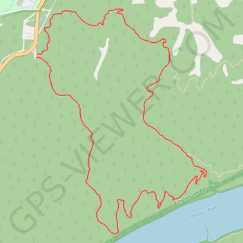
Interactive trail map
Trail profile
- Distance: 5.3 mi
- Elevation gain: 531 ft
- Maximum elevation: 663 ft
- Elevation loss: 531 ft
- Minimum elevation: 509 ft
- Moving time: 1 h 57 m
- Moving speed: 2.7 mph
- Maximum speed: 4.0 mph
- Total time: 2 h 4 m
- Global speed: 2.5 mph
About this trail
Name: Lewis & Clark Loop Trail via Clark Trail in Weldon Spring Conservation Area trail, distance, elevation, map, profile, GPS track
Start: Lewis & Clark Trail, O’Fallon, Saint Charles County, Missouri, United States (38.69080 -90.72439)
Coordinates: 38.67564 -90.72440 38.69497 -90.70557
Topography: O’Fallon topographic map, elevation, terrain
Other hiking, mountain biking, running and outdoor activity trails
Click on a trail to view its statistics, map and profile.
Lewis & Clark Loop Trail via Lewis Trail in Weldon Spring Conservation Area
United States > Missouri > Saint Charles County
The Lewis & Clark Loop Trail via the Lewis Trail offers hikers a moderate, scenic route through a mix of wooded areas, creek beds, and elevated ridges, with remarkable views of the Missouri River and nearby Howell Island. As you follow the trail, you will encounter several overlooks, particularly from the…
Distance: 8.4 mi • Elevation gain: 804 ft • Maximum elevation: 663 ft