Import a GPX file

Madibeng Local Municipality trails

Click on a trail to view its statistics, map and profile.
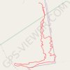
De Wildt Peglarae trail

South Africa > North West > Bojanala Platinum District Municipality > Madibeng Local Municipality

Distance: 5.8 mi • Elevation gain: 1,220 ft • Maximum elevation: 5,318 ft

Gear up for your next adventure:

🩳Quick‑Dry Hiking Shorts - Comfortable and quick‑dry shorts for summer hiking
🗺️NatGeo Topo Maps - High-quality waterproof printed topographic maps of US Parks
🛠️Backpacking Tool Kit - Essential toolkit for outdoor repairs
📚Navigation Handbooks - Master the art of reading topographic maps and using a compass
🎒Hydration Pack - Hands‑free water reservoir for long hikes

As an Amazon Associate, this site earns from qualifying purchases at no extra cost to you.