Import a GPX file

Kirkton of Auchterhouse trails

Click on a trail to view its statistics, map and profile.
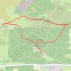
Balkello Community Woodland Loop Walk

United Kingdom > Scotland > Angus > Kirkton of Auchterhouse > Newtown of Pitpointie

Distance: 2.0 mi • Elevation gain: 312 ft • Maximum elevation: 965 ft
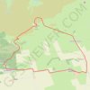
Craigowl Hill Loop

United Kingdom > Scotland > Angus > Kirkton of Auchterhouse > Newtown of Pitpointie

Loop run / hike from Balkello Community Woodland to Craigowl Hill. #Running #Hiking #Loop #Nature #Forest #Countryside

Distance: 5.8 mi • Elevation gain: 1,017 ft • Maximum elevation: 1,480 ft

Other places

Gear up for your next adventure:

🥩Freeze-Dried Meals - Nutritious and lightweight food for remote expeditions
🖼️Topo Map Wall Art - Decorative topographic prints of famous peaks and regions
🌲Outdoor Survival Books - Best books on survival skills
⛺Backpacking Tent - Lightweight and durable tent for multi‑day hikes
🌐World Map Poster - Decorative world maps with topographic info

As an Amazon Associate, this site earns from qualifying purchases at no extra cost to you.