Import a GPX file

Municipality of Colchester trails

Click on a trail to view its statistics, map and profile.
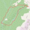
Mi'kmawey Debert Interpretive Trail

Canada > Nova Scotia > Municipality of Colchester > Debert

Distance: 2.8 mi • Elevation gain: 121 ft • Maximum elevation: 108 ft
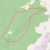
Mi'Kmawey Interpretive Trail

Canada > Nova Scotia > Municipality of Colchester > Debert

#Hiking #Running #Loop

Distance: 2.6 mi • Elevation gain: 98 ft • Maximum elevation: 108 ft

Sandy Cope Loop

Canada > Nova Scotia > Municipality of Colchester > Upper Kemptown

Loop hike via Yellow Birch Trail, Earlton Lake & Portage Trail, Sandy Cope Loop, Donald's Falls and Willard Kitchener MacDonald Trail in the Gully Lake Wilderness Area. #Hiking #Loop #Nature #Forest #Falls #Wilderness

Distance: 3.3 mi • Elevation gain: 344 ft • Maximum elevation: 656 ft

Brookfield - Halifax

Canada > Nova Scotia > Municipality of Colchester > Brookfield

#Bike #Brookfield #Halifax

Distance: 57.3 mi • Elevation gain: 2,159 ft • Maximum elevation: 217 ft

Other places

 •  •

Gear up for your next adventure:

🔭Stargazing Telescopes - Perfect for camping in low-light pollution areas shown on maps
🥾Women's Hiking Boots - Top-rated trail boots with ankle support and superior grip
📖Nature Tracking Books - Learn to track wildlife and terrain
📱Heavy-Duty Phone Cases - Drop-proof and waterproof protection for outdoor navigation
🔥Camping Stove - Portable stove for camping and backcountry cooking

As an Amazon Associate, this site earns from qualifying purchases at no extra cost to you.