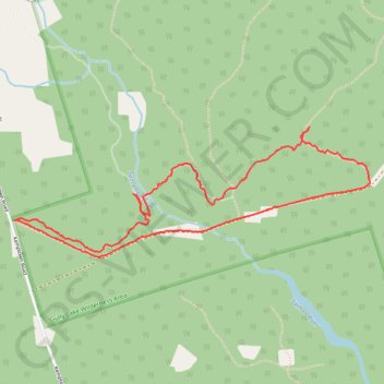
Sandy Cope Loop
Loop hike via Yellow Birch Trail, Earlton Lake & Portage Trail, Sandy Cope Loop, Donald's Falls and Willard Kitchener MacDonald Trail in the Gully Lake Wilderness Area. #Hiking #Loop #Nature #Forest #Falls #Wilderness
- Distance: 3.3 mi
- Elevation gain: 344 ft
- Maximum elevation: 656 ft
- Elevation loss: 341 ft
- Minimum elevation: 479 ft
- Moving time: 1 h 34 m
- Moving speed: 2.1 mph
- Maximum speed: 3.6 mph
- Total time: 2 h 8 m
- Global speed: 1.5 mph
Interactive trail map
Trail profile
- Distance: 3.3 mi
- Elevation gain: 344 ft
- Maximum elevation: 656 ft
- Elevation loss: 341 ft
- Minimum elevation: 479 ft
- Moving time: 1 h 34 m
- Moving speed: 2.1 mph
- Maximum speed: 3.6 mph
- Total time: 2 h 8 m
- Global speed: 1.5 mph
About this trail
Name: Sandy Cope Loop trail, distance, elevation, map, profile, GPS track
Coordinates: 45.53723 -63.11345 45.54341 -63.08949
Other hiking, mountain biking, running and outdoor activity trails
Click on a trail to view its statistics, map and profile.
Pictou - Brookfield
Canada > Nova Scotia > Town of Pictou > Pictou
#Bike #Pictou #Brookfield
Distance: 44.4 mi • Elevation gain: 1,755 ft • Maximum elevation: 682 ft