Import a GPX file

Le Cornet trails

Click on a trail to view its statistics, map and profile.
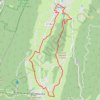
B12 A la découverte des deux villages, départ Autr

France > Auvergne-Rhône-Alpes > Isère > Autrans-Méaudre en Vercors > Autrans > Le Cornet

Distance: 10.1 mi • Elevation gain: 1,129 ft • Maximum elevation: 3,914 ft

Gear up for your next adventure:

🪑Portable Camp Table - Compact table for campsite meals
🧣Hiking Neck Gaiter - Multi‑use neck protection for outdoor weather
🧤Tactile Hiking Gloves - Keep hands warm while operating GPS and smartphone screens
🌡️Portable Weather Meter - Track weather conditions on the trail
📖Nature Tracking Books - Learn to track wildlife and terrain

As an Amazon Associate, this site earns from qualifying purchases at no extra cost to you.