Import a GPX file

Queenstown trails

Click on a trail to view its statistics, map and profile.
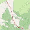
Ben Lomond Track to Saddle in Ben Lomond Scenic Reserve

New Zealand > Otago > Queenstown-Lakes District > Queenstown

Distance: 4.7 mi • Elevation gain: 1,831 ft • Maximum elevation: 4,288 ft

Gear up for your next adventure:

🩳Quick‑Dry Hiking Shorts - Comfortable and quick‑dry shorts for summer hiking
🧴Hand Sanitizer - Keep hands clean while hiking
🌧️Backpack Rain Cover - Keep gear dry in wet weather
🗺️NatGeo Topo Maps - High-quality waterproof printed topographic maps of US Parks
🪶Compact Camp Shovel - Folding shovel for campsite tasks

As an Amazon Associate, this site earns from qualifying purchases at no extra cost to you.