Import a GPX file

Northwest Territories trails

Click on a trail to view its statistics, map and profile.
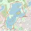
Yellowknife - Frame Lake

Canada > Northwest Territories > North Slave Region > Yellowknife

#Hiking #Loop #Frame

Distance: 3.7 mi • Elevation gain: 118 ft • Maximum elevation: 653 ft

Virginia Falls - Nahanni National Park Reserve

Canada > Northwest Territories > Dehcho Region

#Hiking

Distance: 2.0 mi • Elevation gain: 469 ft • Maximum elevation: 1,900 ft

Other places

 •

Gear up for your next adventure:

🗺️NatGeo Topo Maps - High-quality waterproof printed topographic maps of US Parks
🎒Trail Energy Bars - High‑calorie bars for hiking energy
🩳Quick‑Dry Hiking Shorts - Comfortable and quick‑dry shorts for summer hiking
🧭Outdoor Navigation Book - Learn advanced navigation skills
🌧️Backpack Rain Cover - Keep gear dry in wet weather

As an Amazon Associate, this site earns from qualifying purchases at no extra cost to you.