Yellowknife - Frame Lake
Interactive trail map
Trail profile
- Distance: 3.7 mi
- Elevation gain: 118 ft
- Maximum elevation: 653 ft
- Elevation loss: 118 ft
- Minimum elevation: 607 ft
About this trail
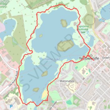
Name: Yellowknife - Frame Lake trail, distance, elevation, map, profile, GPS track
Coordinates: 62.44662 -114.40202 62.46259 -114.37579