Import a GPX file

Amberley Village trails

Click on a trail to view its statistics, map and profile.
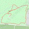
Southeast French Park Loop Walk

United States > Ohio > Hamilton County > Amberley Village > Brookwood

Distance: 2.6 mi • Elevation gain: 282 ft • Maximum elevation: 853 ft

Other places

Gear up for your next adventure:

🗺️Topographic Maps - Detailed topo maps for hiking, exploring and outdoor navigation
🥤Water Filter Bottle - All‑in‑one filter bottle for safe hydration
🧭Orienteering Set - Complete compass and map reading kit
📷Action Camera - Capture your outdoor adventures in HD
🛡️Insect Repellent - Protection against bugs during outdoor activities

As an Amazon Associate, this site earns from qualifying purchases at no extra cost to you.