Import a GPX file

Queens County trails

Click on a trail to view its statistics, map and profile.
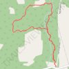
Dromore South Loop

Canada > Prince Edward Island > Queens County > Dromore

Distance: 2.6 mi • Elevation gain: 131 ft • Maximum elevation: 171 ft

Charlottetown to Stratford on bicycle

Canada > Prince Edward Island > Queens County > Charlottetown

Distance: 6.0 mi • Elevation gain: 167 ft • Maximum elevation: 75 ft
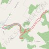
Breadalbane Nature Loop Trail

Canada > Prince Edward Island > Queens County > Breadalbane

Distance: 4.1 mi • Elevation gain: 171 ft • Maximum elevation: 171 ft

Other places

 •  •

Gear up for your next adventure:

🧥Men's Rain Shells - Premium waterproof and breathable jackets for mountain weather
🥇GPS Hiking Watch - Multi‑sport GPS watch with navigation and trail tracking
🗺️Topographic Maps - Detailed topo maps for hiking, exploring and outdoor navigation
🌡️Handheld Weather Meters - Measure wind, temp, and pressure for safe mountain travel
🚑Emergency Bivvies - Heat-reflective sleeping bags for survival situations

As an Amazon Associate, this site earns from qualifying purchases at no extra cost to you.