Import a GPX file

Region of Nitra trails

Click on a trail to view its statistics, map and profile.
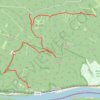
Jelenlegi nyomvonal: 23 SZE 2016 10:34

Slovakia > Region of Nitra > District of Nové Zámky > Chľaba

Distance: 5.3 mi • Elevation gain: 955 ft • Maximum elevation: 1,257 ft

Other places

Gear up for your next adventure:

🥇GPS Hiking Watch - Multi‑sport GPS watch with navigation and trail tracking
🪶Fire Starter Kit - Reliable fire starter for survival and camping
🪵Folding Camp Saw - Compact saw for wood and campsite work
⛺Backpacking Tents - Weight-optimized shelters for multi-day topographic surveys
🛏️Cold Weather Sleeping Bag - Warm sleeping bag for cold conditions

As an Amazon Associate, this site earns from qualifying purchases at no extra cost to you.