Import a GPX file

District of Nové Zámky trails

Click on a trail to view its statistics, map and profile.
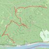
Jelenlegi nyomvonal: 23 SZE 2016 10:34

Slovakia > Region of Nitra > District of Nové Zámky > Chľaba

Distance: 5.3 mi • Elevation gain: 955 ft • Maximum elevation: 1,257 ft

Other places

Gear up for your next adventure:

🕶️GPS Smartphone Mount - Secure mount for phone navigation
🎒Trail Energy Bars - High‑calorie bars for hiking energy
📡GPS Antenna Upgrade - Enhance GPS reception in remote terrain
🪶Thermal Camp Blanket - Extra warmth for cold nights
📶Vehicle Signal Boosters - Improve reception in rural areas while driving to trailheads

As an Amazon Associate, this site earns from qualifying purchases at no extra cost to you.