Import a GPX file

Coramba trails

Click on a trail to view its statistics, map and profile.
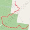
Orara West State Forest

Australia > New South Wales > Coramba

Morning Run

Distance: 5.4 mi • Elevation gain: 1,660 ft • Maximum elevation: 1,207 ft

Star Creek / Comlaroi Road explore

Australia > New South Wales > Coramba

Distance: 3.1 mi • Elevation gain: 745 ft • Maximum elevation: 1,010 ft

Retreat road

Australia > New South Wales > Coramba

Evening Walk

Distance: 1.6 mi • Elevation gain: 358 ft • Maximum elevation: 725 ft

Gear up for your next adventure:

💧Water Filtration Bottles - Safely drink from streams and lakes while exploring
🧭Pro Hiking Compasses - High-accuracy liquid-filled compasses for topographic orientation
🧢Sun Protection Hats - Wide-brimmed and UPF-rated hats for high-altitude sun safety
🌡️Handheld Weather Meters - Measure wind, temp, and pressure for safe mountain travel
🧯Emergency Survival Kit - All‑in‑one survival essentials for the backcountry

As an Amazon Associate, this site earns from qualifying purchases at no extra cost to you.