
Ashfield trails
Click on a trail to view its statistics, map and profile.
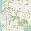
Morris Tract Provincial Nature Reserve - Maitland River
Canada > Ontario > Huron County > Ashfield–Colborne–Wawanosh
Lake Huron. #Hiking #Loop #MorrisTract #Huron
Distance: 14.7 mi • Elevation gain: 1,066 ft • Maximum elevation: 906 ft
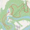
Morris Tract Provincial Nature Reserve - Maitland River
Canada > Ontario > Huron County > Ashfield–Colborne–Wawanosh
#Hiking #Loop #MorrisTract #Maitland
Distance: 5.8 mi • Elevation gain: 591 ft • Maximum elevation: 879 ft
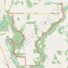
Little Lakes - Benmiller
Canada > Ontario > Huron County > Ashfield–Colborne–Wawanosh
Maitland River. #Hiking
Distance: 12.6 mi • Elevation gain: 968 ft • Maximum elevation: 948 ft

Edge Hill loop walk
United States > Massachusetts > Franklin County > Ashfield
Distance: 1.6 mi • Elevation gain: 322 ft • Maximum elevation: 1,302 ft
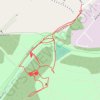
RE SK480600
United Kingdom > England > Nottinghamshire > Ashfield > Sutton in Ashfield > Stanton Hill
Distance: 1.5 mi • Elevation gain: 138 ft • Maximum elevation: 600 ft
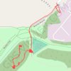
RE SK480600
United Kingdom > England > Nottinghamshire > Ashfield > Sutton in Ashfield > Stanton Hill
Distance: 0.7 mi • Elevation gain: 23 ft • Maximum elevation: 591 ft
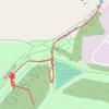
RE SK480600 2
United Kingdom > England > Nottinghamshire > Ashfield > Sutton in Ashfield > Stanton Hill
Distance: 0.5 mi • Elevation gain: 23 ft • Maximum elevation: 587 ft