
Bennington County, Vermont, United States trails
Click on a trail to view its statistics, map and profile.

Lye Brook Falls Trail in Green Mountain National Forest
United States > Vermont > Bennington County > Manchester Center > Manchester
The Lye Brook Falls Trail in Vermont provides a refreshing, immersive experience in the Green Mountain National Forest. The hike is mostly through a tranquil forest of hardwoods, with seasonal variations enhancing the scenery, from wildflowers in spring to vibrant fall colors. Along the way, you'll cross…
Distance: 4.5 mi • Elevation gain: 1,014 ft • Maximum elevation: 1,654 ft
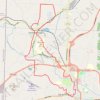
Bicycle loop ride between Bennington and North Bennington
United States > Vermont > Bennington County > Bennington
Distance: 15.1 mi • Elevation gain: 1,083 ft • Maximum elevation: 873 ft
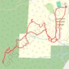
Mount Anthony from Southern Vermont College
United States > Vermont > Bennington County > Bennington > Old Bennington
Distance: 4.9 mi • Elevation gain: 1,575 ft • Maximum elevation: 2,323 ft
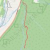
Lye Brook Falls Trail
United States > Vermont > Bennington County > Manchester
Distance: 4.9 mi • Elevation gain: 1,207 ft • Maximum elevation: 1,654 ft