Lye Brook Falls Trail in Green Mountain National Forest
The Lye Brook Falls Trail in Vermont provides a refreshing, immersive experience in the Green Mountain National Forest. The hike is mostly through a tranquil forest of hardwoods, with seasonal variations enhancing the scenery, from wildflowers in spring to vibrant fall colors. Along the way, you'll cross streams and encounter quiet brooks, adding to the sense of serenity, while the 125-foot waterfall at the end offers a stunning climax, framed by moss-covered rocks and a cool mist. #Hiking #Waterfall #Forest #Nature
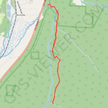
- Distance: 4.5 mi
- Elevation gain: 1,014 ft
- Maximum elevation: 1,654 ft
- Elevation loss: 1,040 ft
- Minimum elevation: 778 ft
- Moving time: 1 h 27 m
- Moving speed: 3.1 mph
- Maximum speed: 8.3 mph
- Total time: 1 h 33 m
- Global speed: 2.9 mph
Interactive trail map
Trail profile
- Distance: 4.5 mi
- Elevation gain: 1,014 ft
- Maximum elevation: 1,654 ft
- Elevation loss: 1,040 ft
- Minimum elevation: 778 ft
- Moving time: 1 h 27 m
- Moving speed: 3.1 mph
- Maximum speed: 8.3 mph
- Total time: 1 h 33 m
- Global speed: 2.9 mph
About this trail
Name: Lye Brook Falls Trail in Green Mountain National Forest trail, distance, elevation, map, profile, GPS track
Coordinates: 43.13134 -73.04150 43.15894 -73.03685
Topography: Bennington County topographic map, elevation, terrain
Other hiking, mountain biking, running and outdoor activity trails
Click on a trail to view its statistics, map and profile.
Lye Brook Falls Trail
United States > Vermont > Bennington County > Manchester
Distance: 4.9 mi • Elevation gain: 1,207 ft • Maximum elevation: 1,654 ft