Import a GPX file

Coffee County, Tennessee, United States trails

Click on a trail to view its statistics, map and profile.
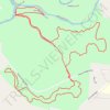
Hike - Southern Old Stone Fort Park Trails

United States > Tennessee > Coffee County > Manchester > Westwood

Distance: 4.5 mi • Elevation gain: 338 ft • Maximum elevation: 1,106 ft

Gear up for your next adventure:

⌚Solar GPS Watches - Advanced multisport watches with built-in topographic maps
🧷Carabiner Set - Durable clips for gear attachment
🔭Compact Binoculars - HD vision for scouting terrain and identifying distant landmarks
🚗GPS Dash Cams - Record your scenic drives through mountain passes and canyons
🪑Portable Camp Table - Compact table for campsite meals

As an Amazon Associate, this site earns from qualifying purchases at no extra cost to you.