
Concord trails
Click on a trail to view its statistics, map and profile.
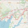
East Coast Greenway from Perryville to Newark
United States > Maryland > Cecil County > Perryville > Concord
Starting in Perryville, this East Coast Greenway ride follows the head of the Chesapeake Bay past Furnace Bay and the historic Principio Furnace area, then rolls through Charlestown toward the waterfront town of North East and the North East River. From North East, the route turns inland through Elk Neck State…
Distance: 25.4 mi • Elevation gain: 1,322 ft • Maximum elevation: 197 ft
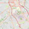
A Better Cobb Group Ride - Mountain to River Trail
United States > Georgia > Cobb County > Smyrna
Distance: 18.4 mi • Elevation gain: 722 ft • Maximum elevation: 1,158 ft
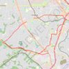
Bike ride to bus stop to go into town, then circle back along the silver comet trail and ride the newly paved part of the beltline connector
United States > Georgia > Cobb County > Smyrna
Distance: 14.9 mi • Elevation gain: 896 ft • Maximum elevation: 1,093 ft
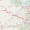
More bike ride on the Silver Comet Trail (and some other side quests)
United States > Georgia > Polk County
Distance: 47.8 mi • Elevation gain: 2,802 ft • Maximum elevation: 1,148 ft

Access from Bailey Rd / Clayton Rd to Newhall Park
United States > California > Contra Costa County > Concord
Distance: 4.8 mi • Elevation gain: 69 ft • Maximum elevation: 259 ft

Walden Pond Loop
United States > Massachusetts > Middlesex County > Concord
Distance: 1.9 mi • Elevation gain: 135 ft • Maximum elevation: 207 ft
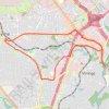
Bicycle ride around Smyrna, mostly on bike trails
United States > Georgia > Cobb County > Smyrna
Distance: 10.3 mi • Elevation gain: 764 ft • Maximum elevation: 1,093 ft