
Holladay trails
Click on a trail to view its statistics, map and profile.
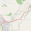
Heughs Canyon Trail to Heughs Creek Falls in Uinta-Wasatch-Cache National Forest
United States > Utah > Salt Lake County > Holladay
The Heughs Canyon Trail to the Heughs Creek Falls offers a serene escape into nature just outside Salt Lake City. The hike begins with a shaded, forested path where the sounds of a nearby creek accompany you. As you ascend, the trail becomes steeper, leading through rocky outcrops and wildflower-dotted…
Distance: 3.0 mi • Elevation gain: 1,329 ft • Maximum elevation: 6,214 ft