Heughs Canyon Trail to Heughs Creek Falls in Uinta-Wasatch-Cache National Forest
The Heughs Canyon Trail to the Heughs Creek Falls offers a serene escape into nature just outside Salt Lake City. The hike begins with a shaded, forested path where the sounds of a nearby creek accompany you. As you ascend, the trail becomes steeper, leading through rocky outcrops and wildflower-dotted clearings. Hikers are rewarded with sweeping views of the Salt Lake Valley and a cascading waterfall nestled in a scenic boulder field. This trail is known for its tranquility and natural beauty, but visitors should be cautious of loose rocks and the potential presence of rattlesnakes. #Hiking #Mountain #Forest #Nature #Waterfall
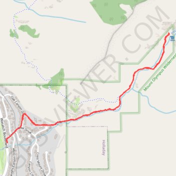
- Distance: 3.0 mi
- Elevation gain: 1,329 ft
- Maximum elevation: 6,214 ft
- Elevation loss: 1,325 ft
- Minimum elevation: 4,885 ft
- Moving time: 54 m 33 s
- Moving speed: 3.3 mph
- Maximum speed: 7.8 mph
- Total time: 1 h 4 m
- Global speed: 2.8 mph
Interactive trail map
Trail profile
- Distance: 3.0 mi
- Elevation gain: 1,329 ft
- Maximum elevation: 6,214 ft
- Elevation loss: 1,325 ft
- Minimum elevation: 4,885 ft
- Moving time: 54 m 33 s
- Moving speed: 3.3 mph
- Maximum speed: 7.8 mph
- Total time: 1 h 4 m
- Global speed: 2.8 mph
About this trail
Name: Heughs Canyon Trail to Heughs Creek Falls in Uinta-Wasatch-Cache National Forest trail, distance, elevation, map, profile, GPS track
Coordinates: 40.63688 -111.79800 40.64632 -111.77953
Topography: Salt Lake County topographic map, elevation, terrain