
Kondalilla trails
Click on a trail to view its statistics, map and profile.
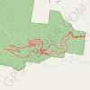
Kondalilla Falls - Rock Pools Loop
Australia > Queensland > Sunshine Coast Regional
Kondalilla National Park. #Hiking #Loop #Kondalilla
Distance: 2.9 mi • Elevation gain: 873 ft • Maximum elevation: 1,115 ft
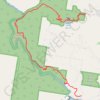
Lake Baroon - Kondalilla Falls
Australia > Queensland > Sunshine Coast Regional
Kondalilla National Park. #Hiking #Baroon #Kondalilla
Distance: 6.0 mi • Elevation gain: 1,637 ft • Maximum elevation: 1,112 ft
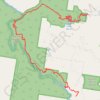
Lake Baroon - Kondalilla Falls
Australia > Queensland > Sunshine Coast Regional
Kondalilla National Park. #Hiking #Baroon #Kondalilla
Distance: 6.8 mi • Elevation gain: 1,909 ft • Maximum elevation: 1,119 ft