
Lake Catherine via Brighton Lakes Trail and Catherine s Pass Trail trails
Click on a trail to view its statistics, map and profile.
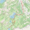
Lake Catherine via Brighton Lakes Trail and Catherine's Pass Trail
United States > Utah > Salt Lake County > Brighton
This hike to Lake Catherine offers an immersive experience in the alpine beauty of the Uinta-Wasatch-Cache National Forest. The route leads you past three picturesque lakes—Lake Mary, Lake Martha, and Lake Catherine—while providing panoramic views of the surrounding peaks, like Mt. Wolverine, and lush…
Distance: 2.2 mi • Elevation gain: 1,224 ft • Maximum elevation: 10,000 ft
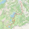
Lake Catherine Loop via Brighton Lakes Trail in Uinta-Wasatch-Cache National Forest
United States > Utah > Salt Lake County > Brighton
The Lake Catherine Loop via Brighton Lakes Trail offers hikers a journey through alpine forests, passing serene bodies of water like Lake Mary, Lake Martha, and Lake Catherine. Along the trail, one can admire the rugged silhouette of Mount Millicent and, during the summer months, vibrant wildflowers that dot…
Distance: 4.7 mi • Elevation gain: 1,342 ft • Maximum elevation: 10,033 ft