Import a GPX file

Pine Mountain Club trails

Click on a trail to view its statistics, map and profile.
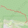
San Emigdio Mountain Eastern Approach

United States > California > Kern County > Pine Mountain Club

Distance: 7.1 mi • Elevation gain: 2,700 ft • Maximum elevation: 7,467 ft

Gear up for your next adventure:

🛰️Handheld GPS Units - Professional satellite navigators for precise backcountry mapping
🛏️Cold Weather Sleeping Bag - Warm sleeping bag for cold conditions
🔊Portable Camp Speaker - Music and alerts at camp
🧭Orienteering Set - Complete compass and map reading kit
🏫Relief Map Kits - Hands-on tools for teaching landforms and elevation

As an Amazon Associate, this site earns from qualifying purchases at no extra cost to you.