Import a GPX file

Robson trails

Click on a trail to view its statistics, map and profile.

Christina Lake - Castlegar

Canada > British Columbia > Regional District of Kootenay Boundary > Area C (Christina Lake) > Christina Lake

#Bike #Christina #Castlegar

Distance: 49.4 mi • Elevation gain: 4,744 ft • Maximum elevation: 5,075 ft

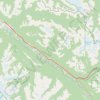
Mount Robson Provincial Park - Jasper

Canada > British Columbia > Regional District of Fraser-Fort George > Area H (Robson Valley/Canoe)

#Bike #Robson #Jasper

Distance: 57.3 mi • Elevation gain: 3,314 ft • Maximum elevation: 3,845 ft

McBride - Mount Robson Provincial Park

Canada > British Columbia > Regional District of Fraser-Fort George > McBride

#Bike #McBride #Robson

Distance: 48.3 mi • Elevation gain: 2,644 ft • Maximum elevation: 2,943 ft

Castlegar - Crawford Bay

Canada > British Columbia > Regional District of Central Kootenay > Area J (Lower Arrow/Columbia) > Raspberry

Kootenay River. #Bike

Distance: 56.6 mi • Elevation gain: 3,917 ft • Maximum elevation: 2,277 ft

Gear up for your next adventure:

🌲Outdoor Survival Books - Best books on survival skills
🥩Freeze-Dried Meals - Nutritious and lightweight food for remote expeditions
🧭Orienteering Set - Complete compass and map reading kit
🚗GPS Dash Cams - Record your scenic drives through mountain passes and canyons
🔋Solar Power Banks - Keep your GPS and phone charged in remote wilderness areas

As an Amazon Associate, this site earns from qualifying purchases at no extra cost to you.